Huangyaguan Great Wall, Jiangjunguan “General’s Pass”, and in between
Photos from hikes along the line of Great Wall that runs from Huangyaguan in Tianjin through to Jiangjunguan in Beijing’s Pinggu District.
What’s in this post?
A mostly uninterrupted line of Great Wall runs westward through the mountains from the Huangyaguan Great Wall, ending up at Jiangjunguan, the “General’s Pass”.
This line of Great Wall blocks off some of the minor passes through the mountains between Beijing and Hebei, and at Huangyaguan it blocks a major pass.
Between Huangyaguan and Jiangjunguan is the Hongshimen part of the Great Wall, and the ‘Sanjiebei’, which is a tablet that marks the junction of Beijing Muncipality, Tianjin Municipality, and Hebei Province. This is where the Great Wall enters Beijing from the east, coming in from Shanhaiguan by the sea.
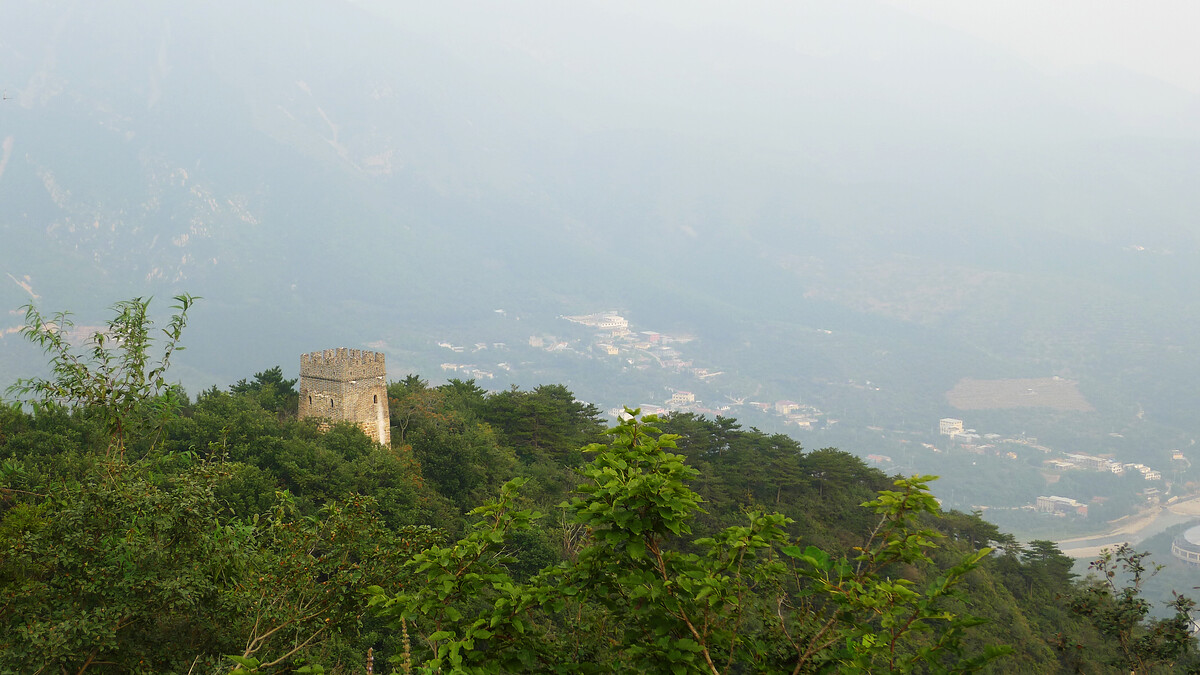
Huangyaguan was fortified as early as the Northern Qi Dynasty (550-577 AD), with Tang Dynasty records from 747 AD mentioning a garrison. The Great Wall here was expanded during the Yongle period of the Ming Dynasty (1368–1644 AD, Yongle period 1403–1424 AD), with more work done in the late 1500s. Its current look is late Ming-era, with brickwork and large towers, fixed up and repaired in 1987.
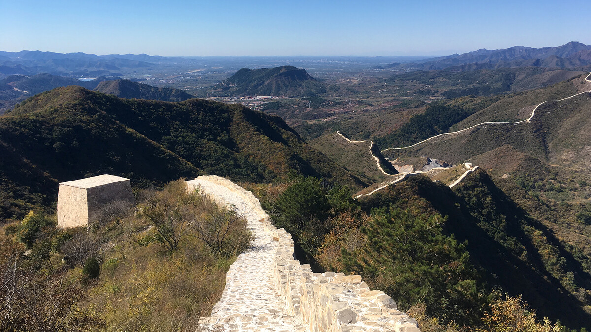
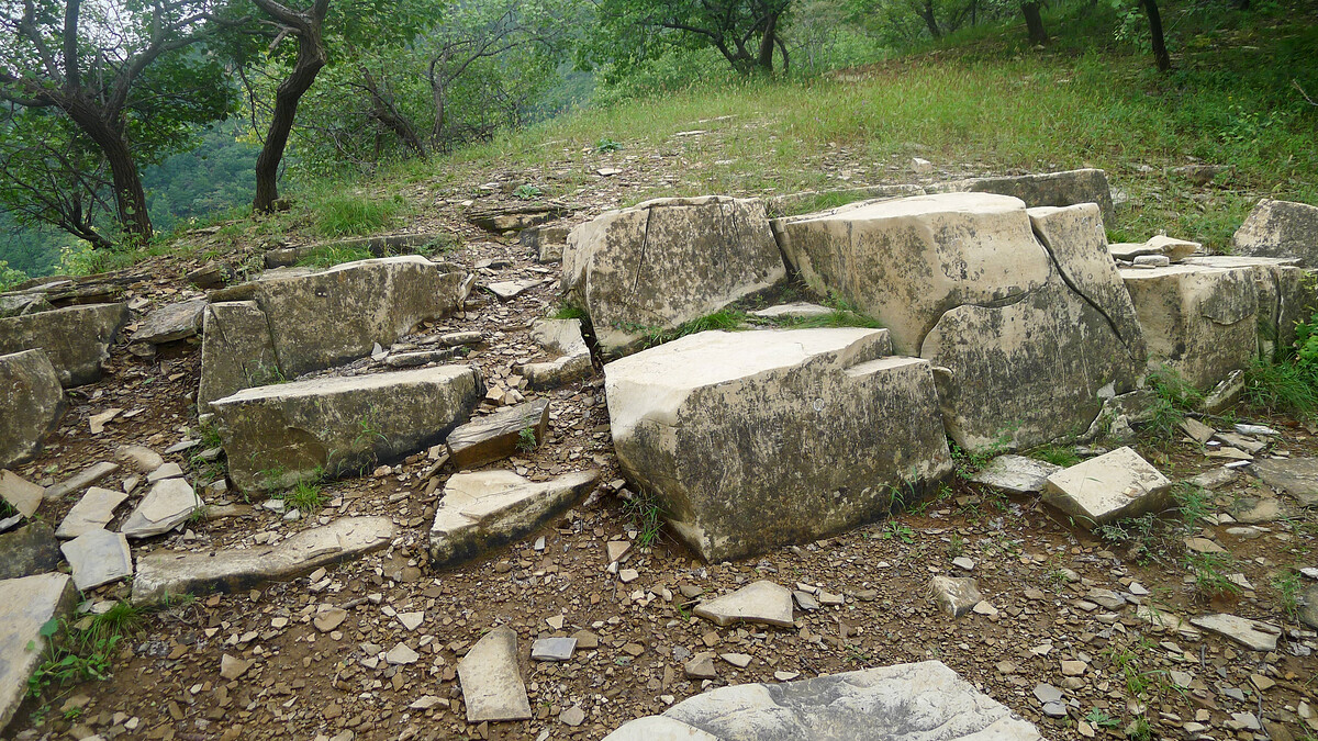
The other repairs to the wall in this area were not done as tastefully. The 3km of Great Wall that runs down from the Sanjiebei, on the Beijing side of the border, is now an example of the cover-it-in-concrete style of repair work, and the earlier work done at Jiangjunguan was not a whole lot better.
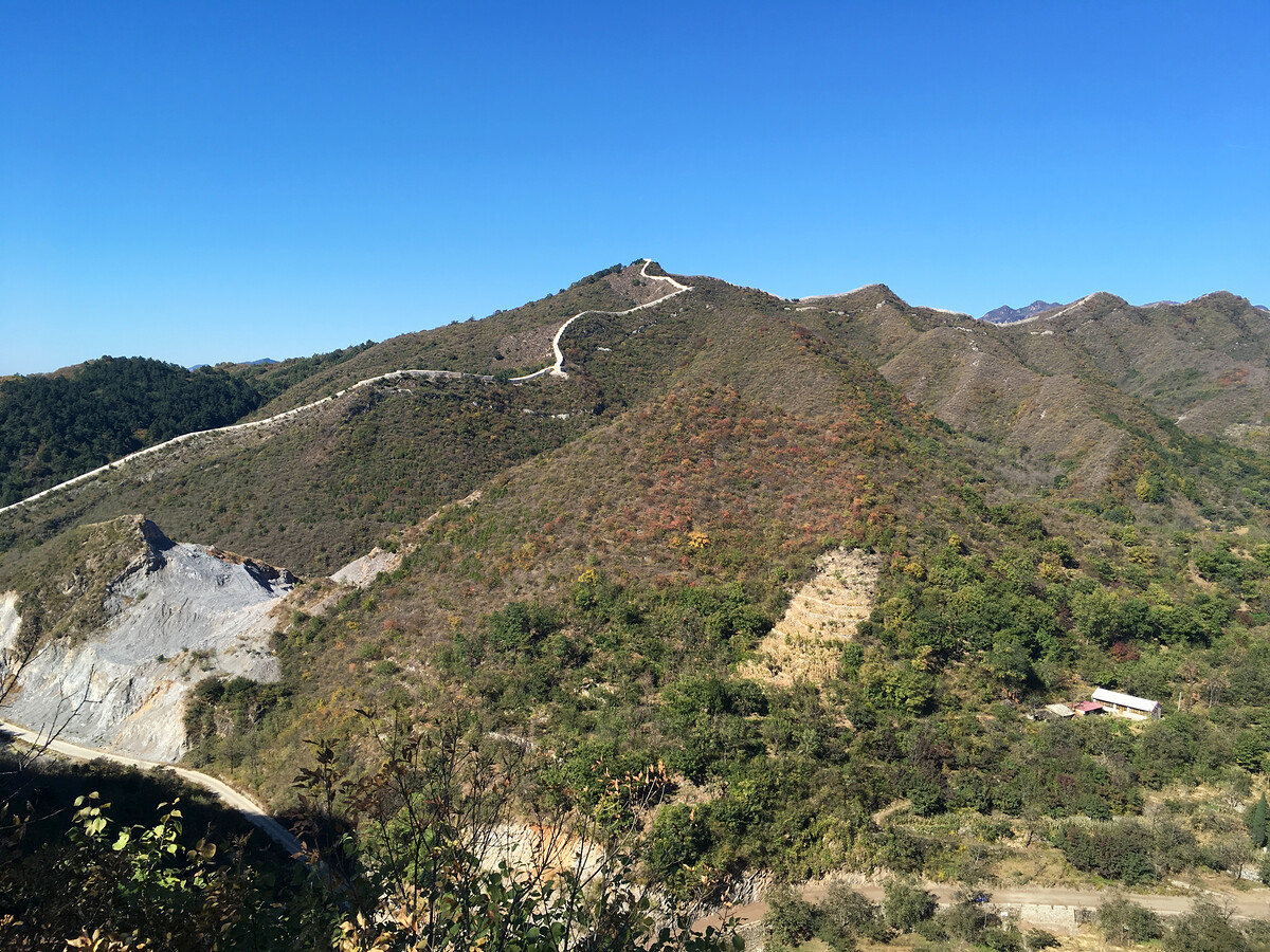
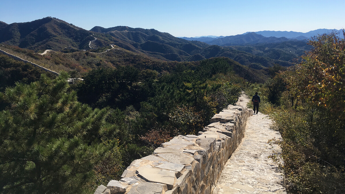
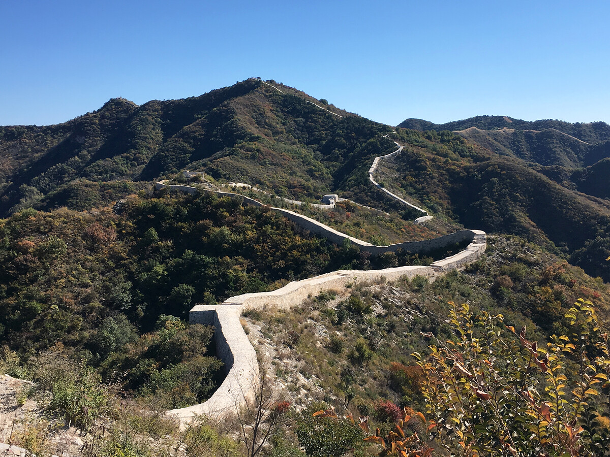
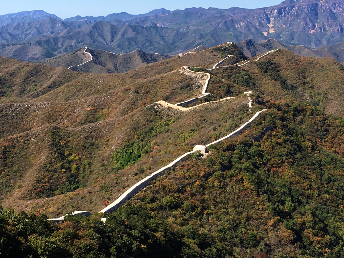
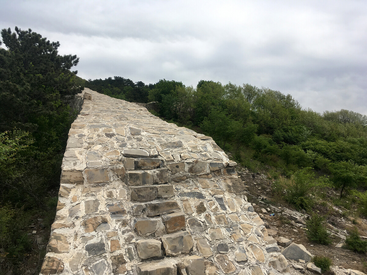
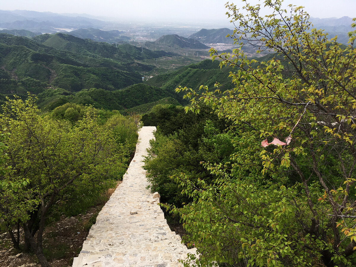
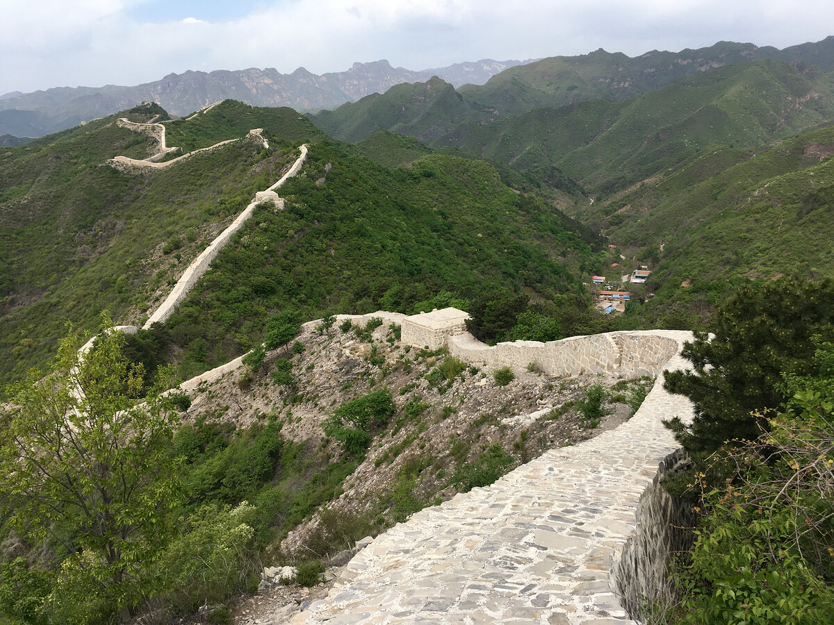
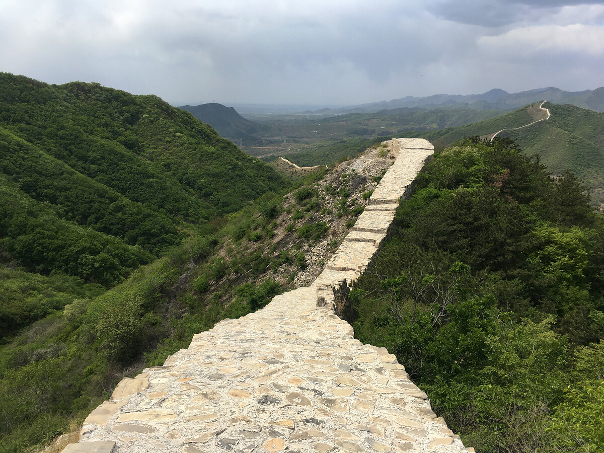
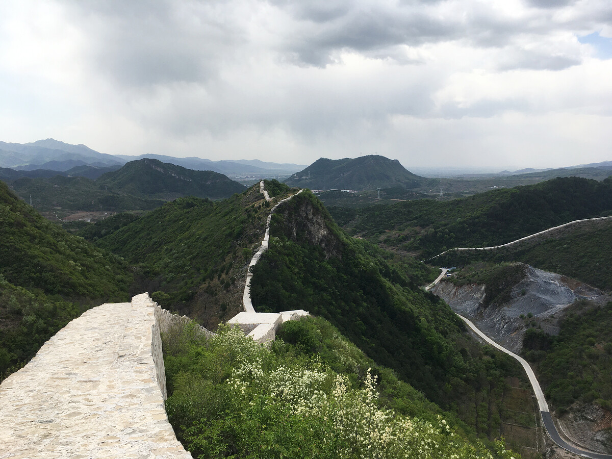
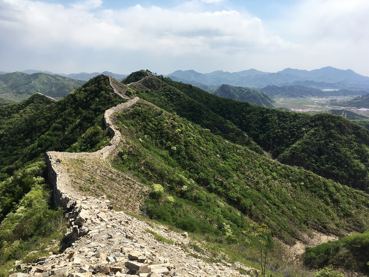
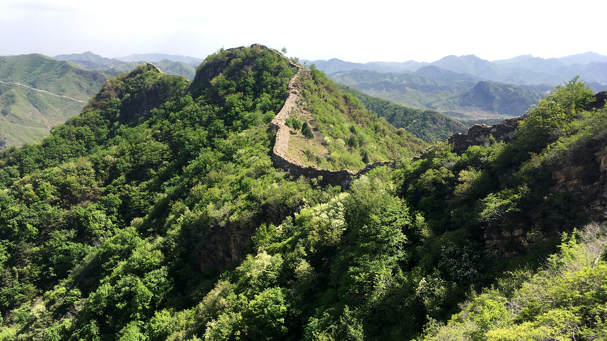
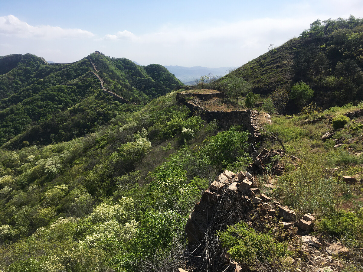
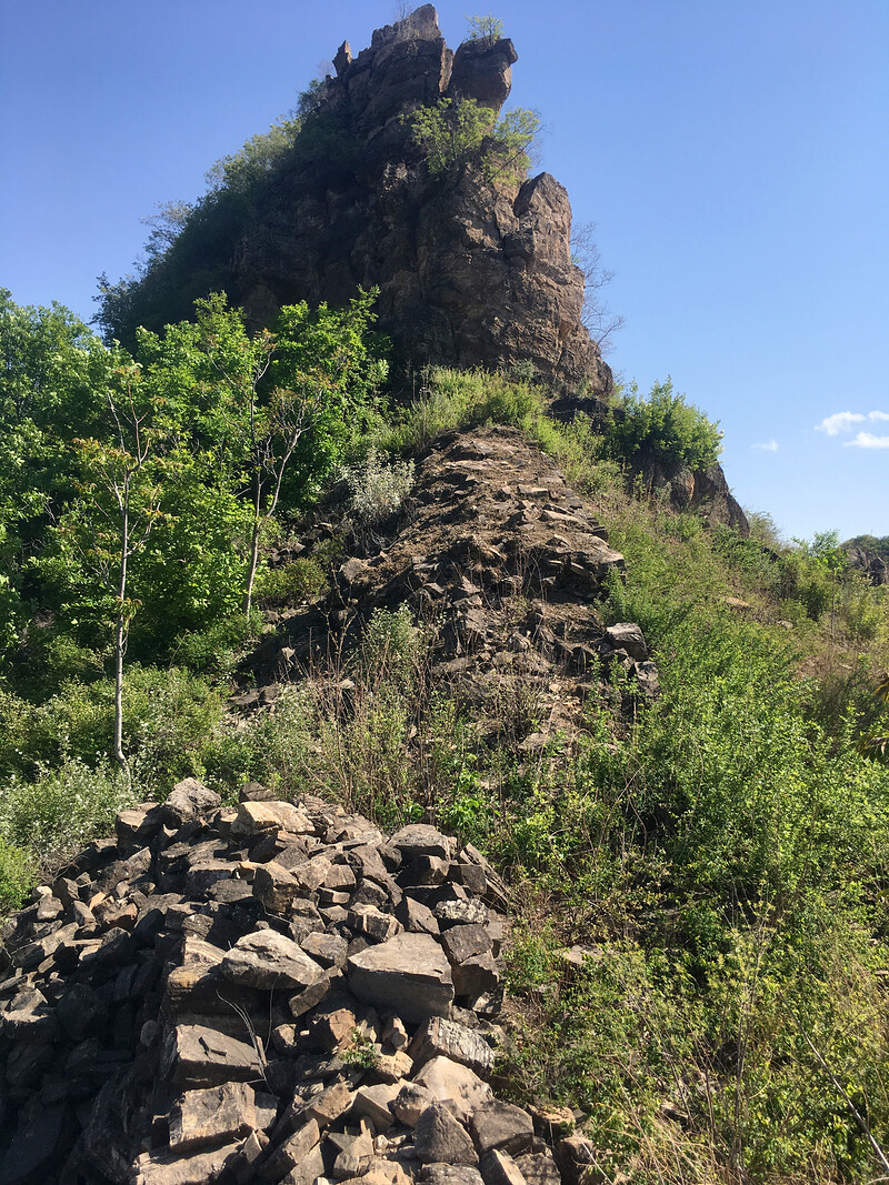
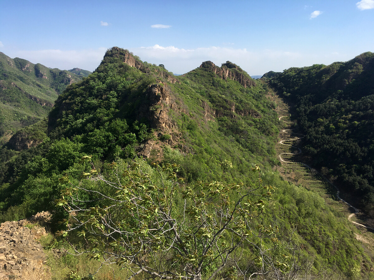
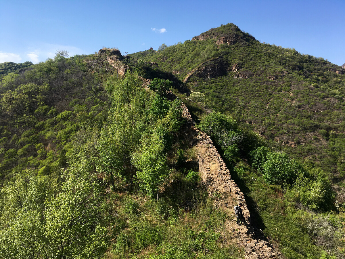
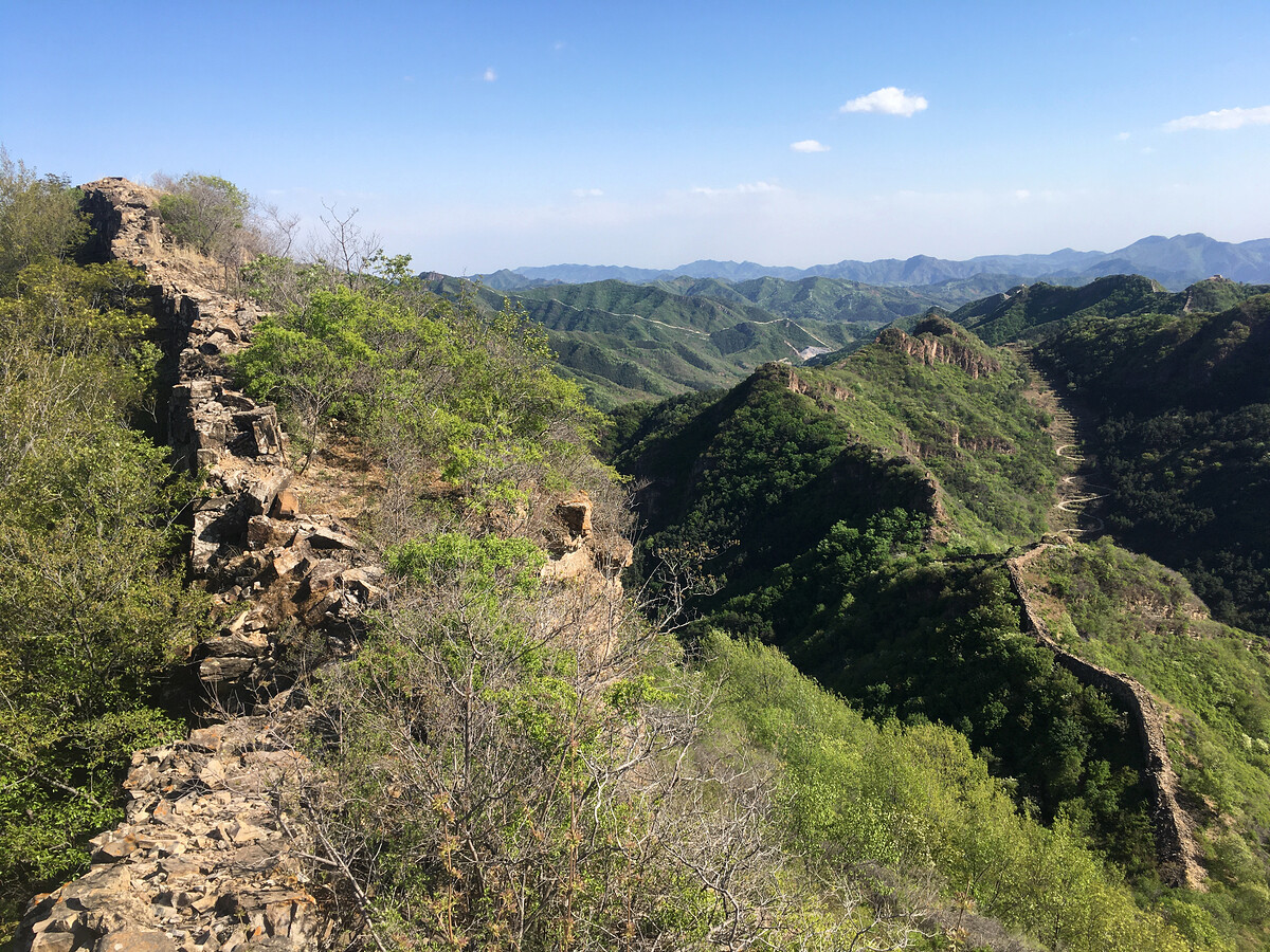
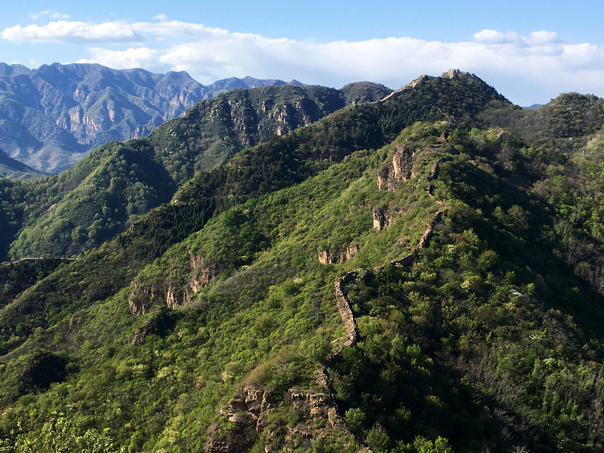
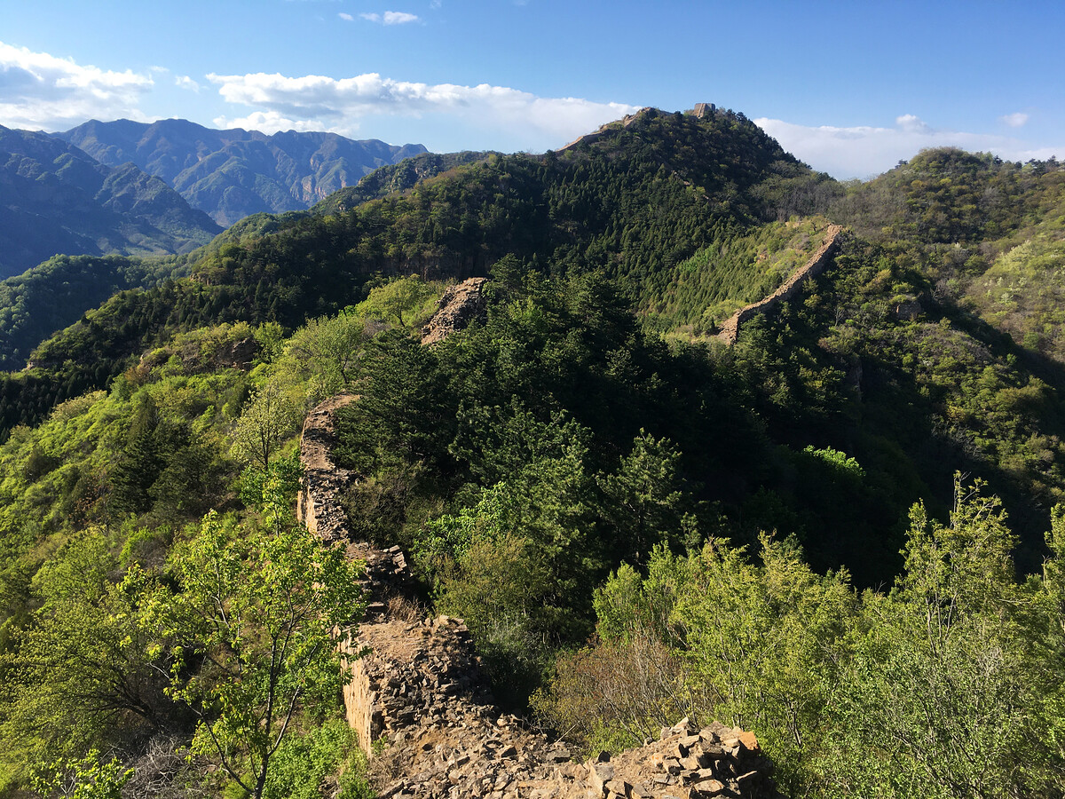
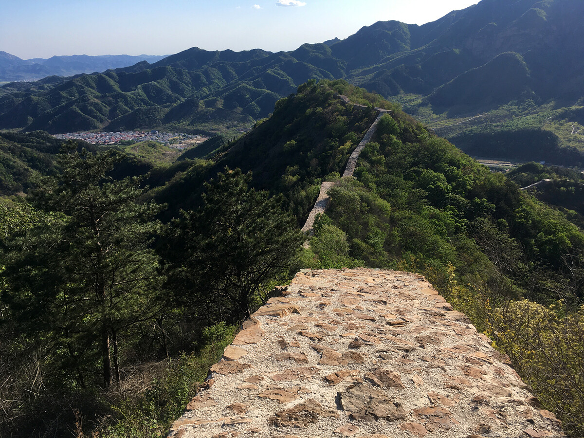
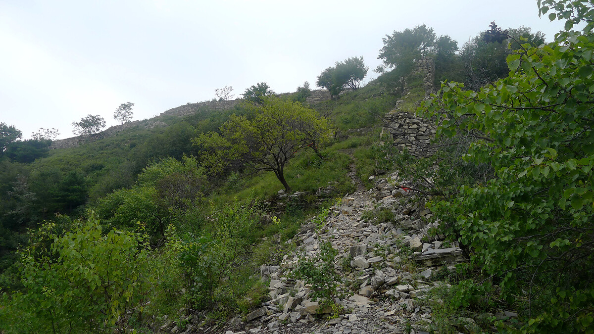
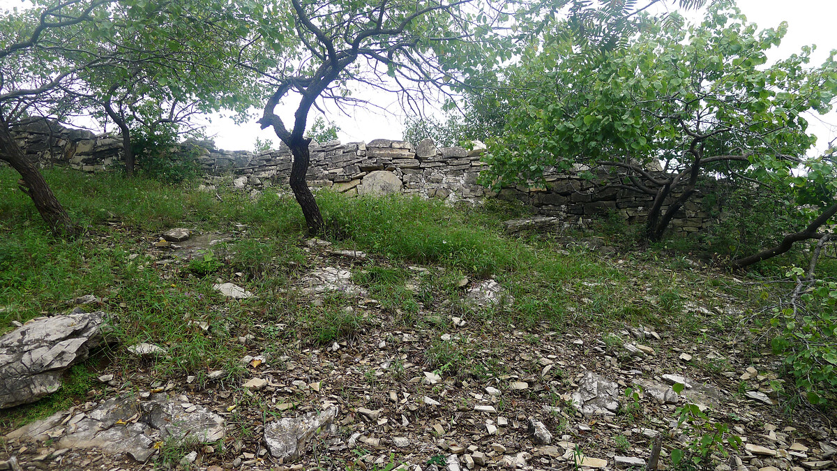
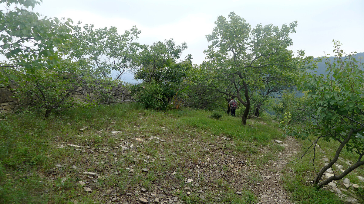
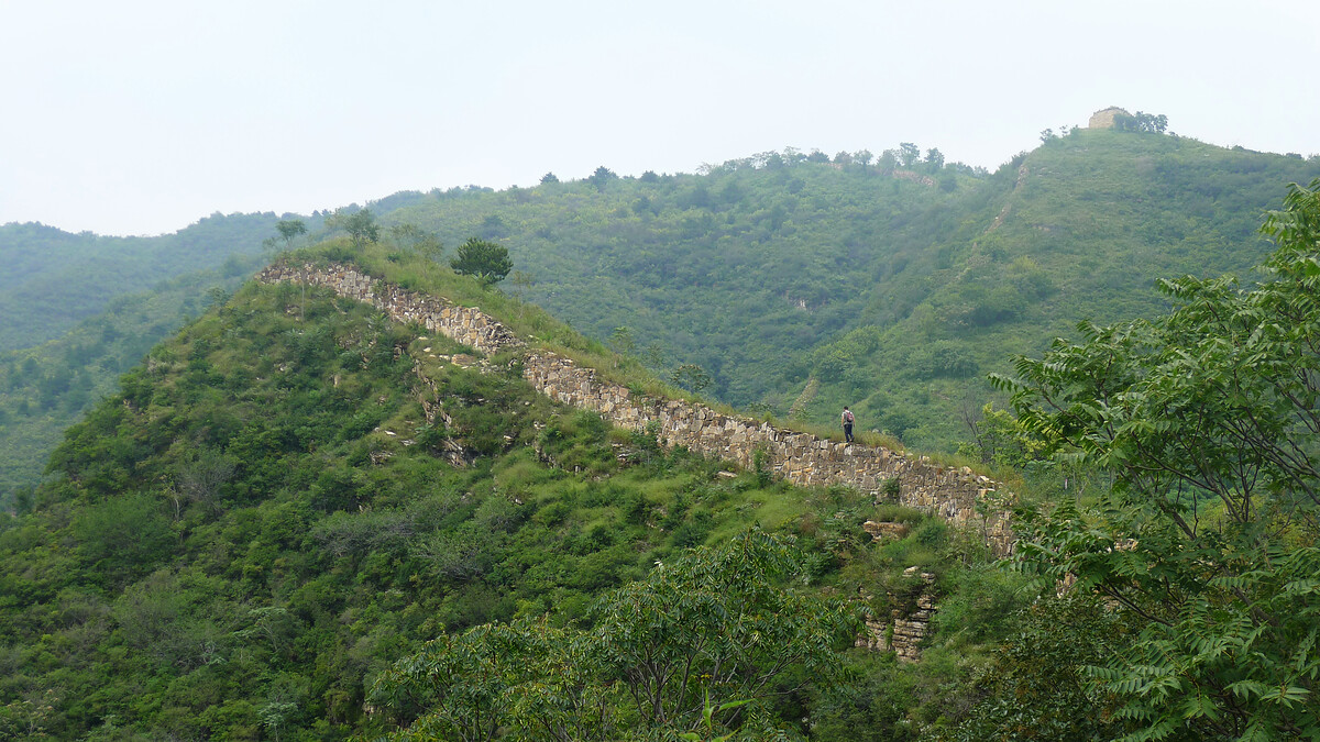
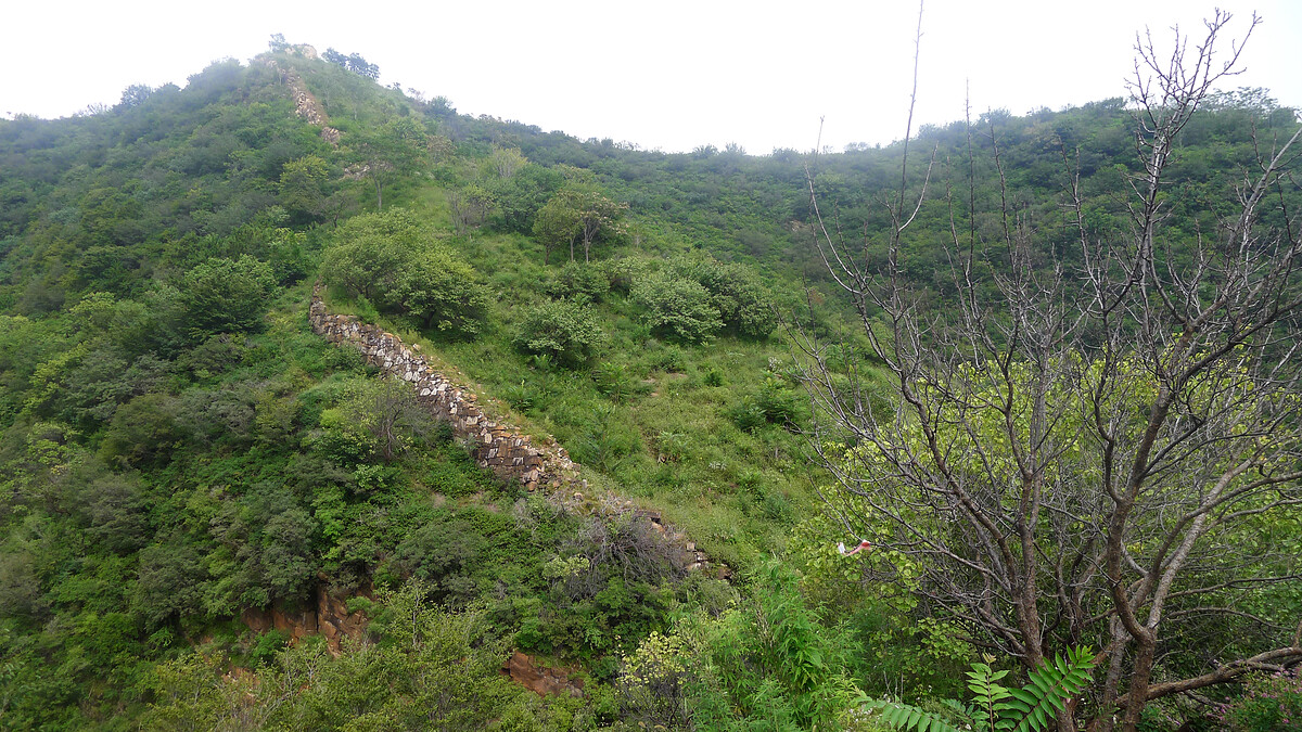
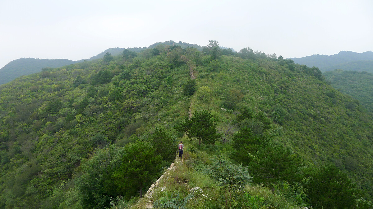
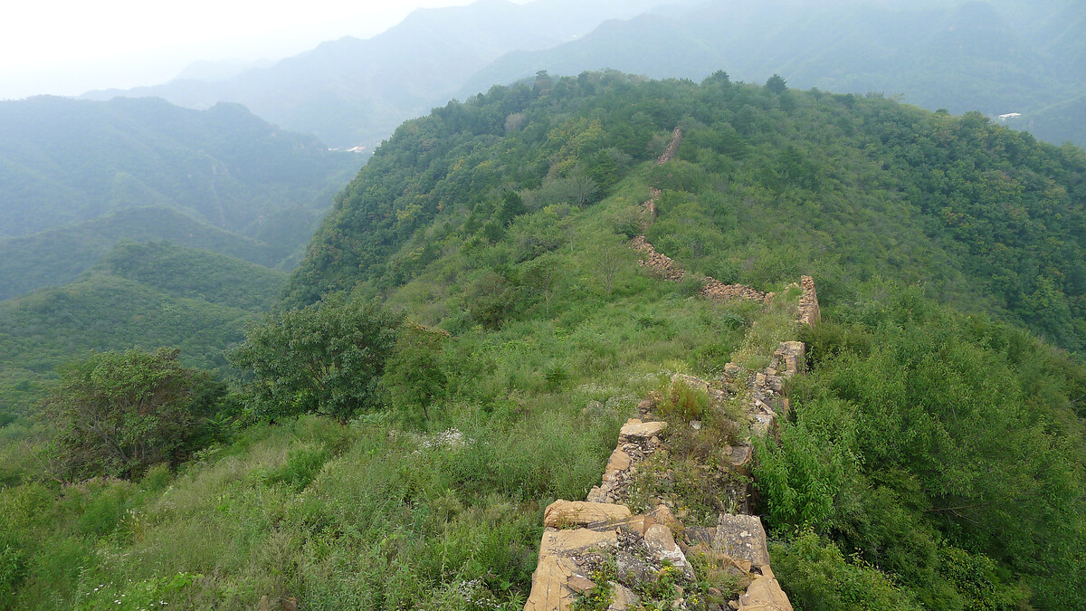
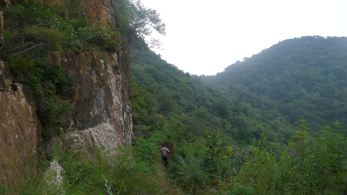
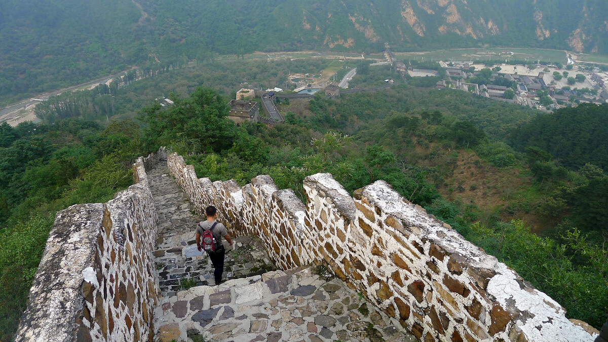
In between the repaired parts, though, is a line of rocks and stones that runs along the ridgelines of wooded hills, disappearing into forests and dropping off at cliffs. The Great Wall here shares the look of the early Ming Dynasty Great Wall on Beijing’s west side—mostly made of fitted rocks and stones, with the blocky foundations of towers seen at semi-regular intervals along the way.
Hongshimen Great Wall and the ‘Sanjiebei’
From the western end of the Hongshimen Great Wall up to the Sanjiebei, then down to Hongshimen Village.
Photos (iPhone SE) from October 2018.
(Didn’t get a good photo of the Sanjiebei on this visit.)
Beijing Hikers has a hike in this area called “On the Border Lines”.
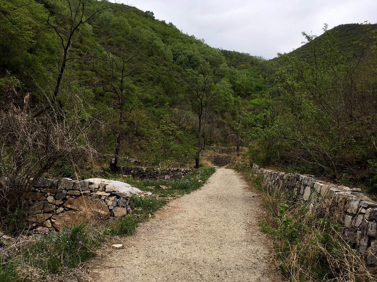
Hongshimen Village, the ‘Sanjiebei’, Jiangjunguan “General’s Pass” Great Wall
From Hongshimen Village up to the Sanjiebei, back down to the Zhangzuo Village end, then up and over to Jiangjunguan. (17km / 1491m ascent / approx. 6 hours)
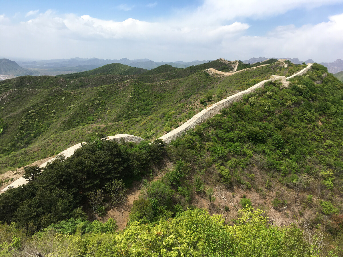
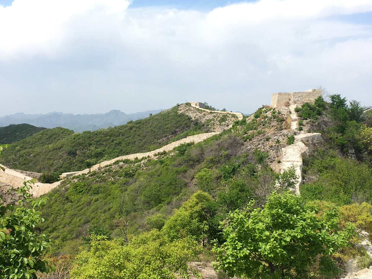
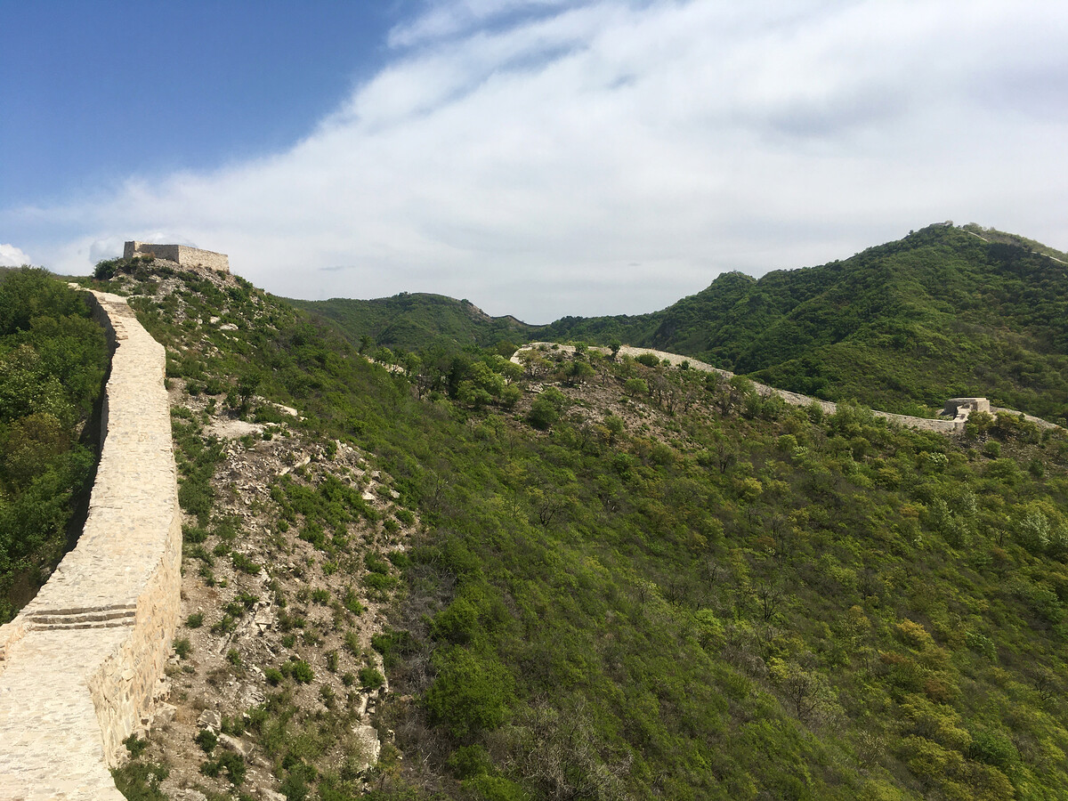
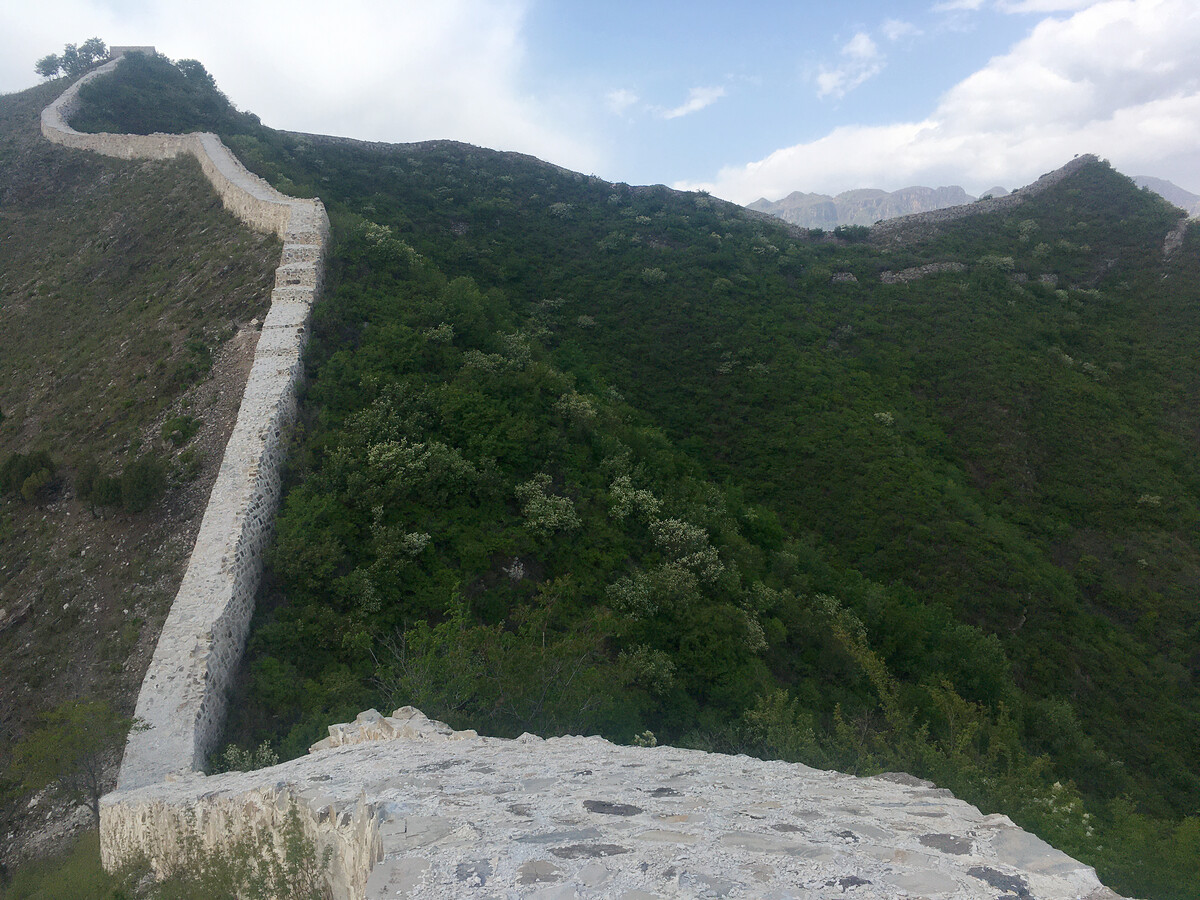
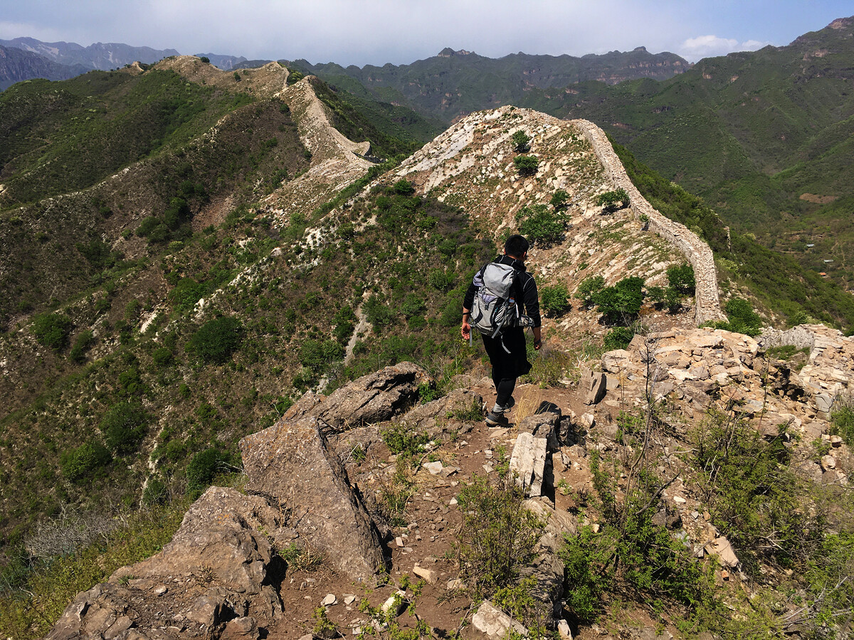
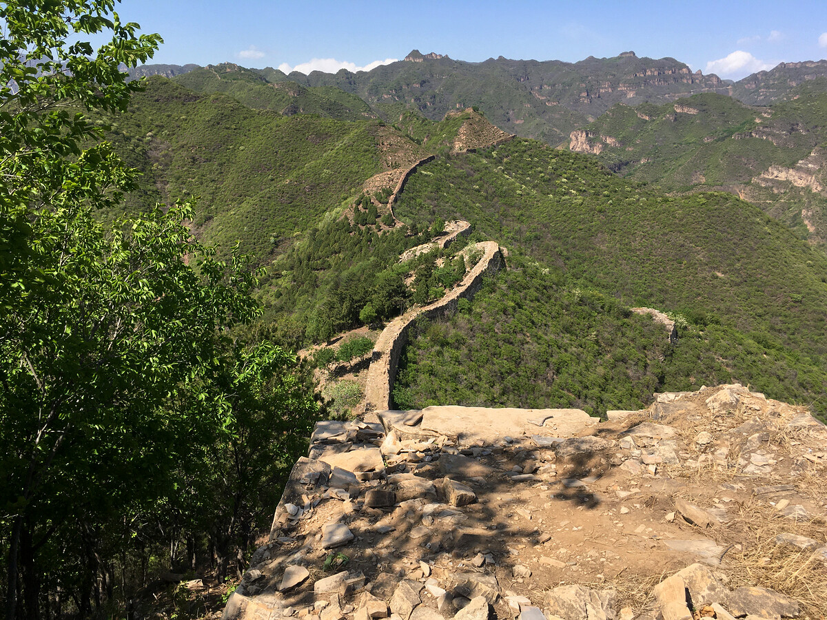
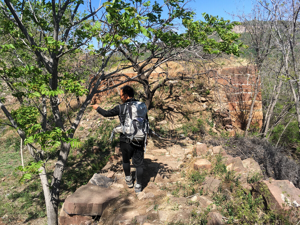
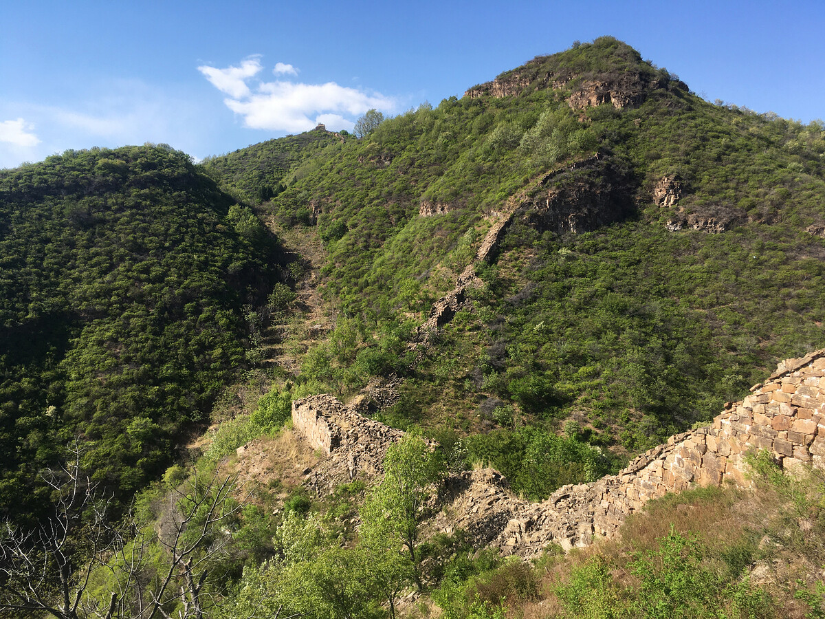
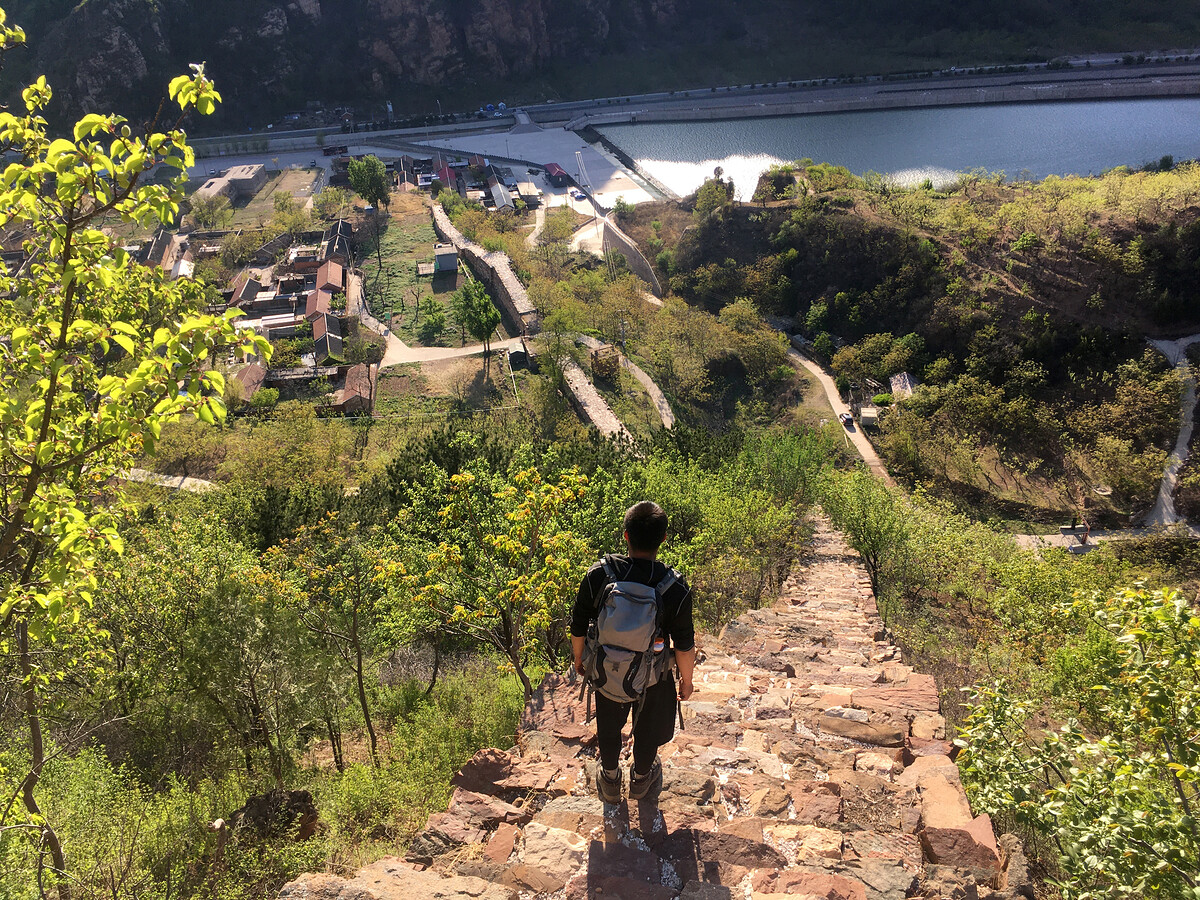
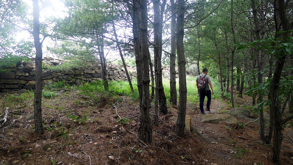
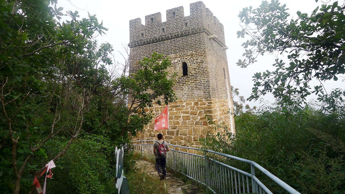
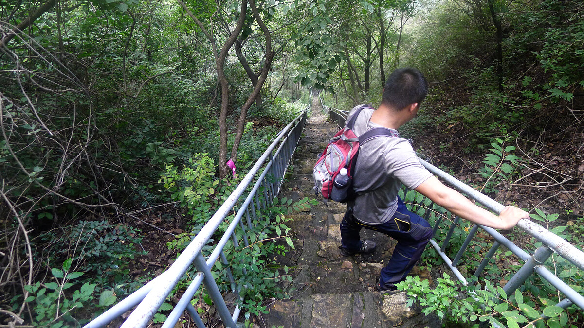
The Great Wall at either end of this part is repaired and fairly horrible to hike. At the Hongshimen end, it’s rocks all concreted together. On the way up from the valley by Zhangzuo Village, it’s also repaired with concrete, with the additional difficulty of having to hoist yourself (and your hiking pack) up steps that are more than a metre tall. At the Jiangjunguan end, the original rocks and stones are held together with concrete, with parts that are steep and not stepped at all.
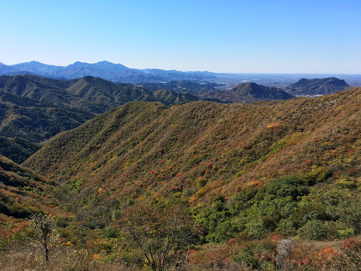
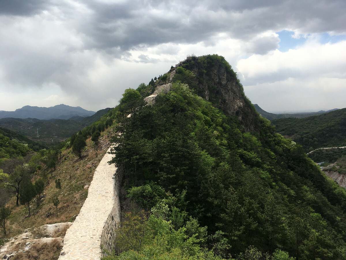
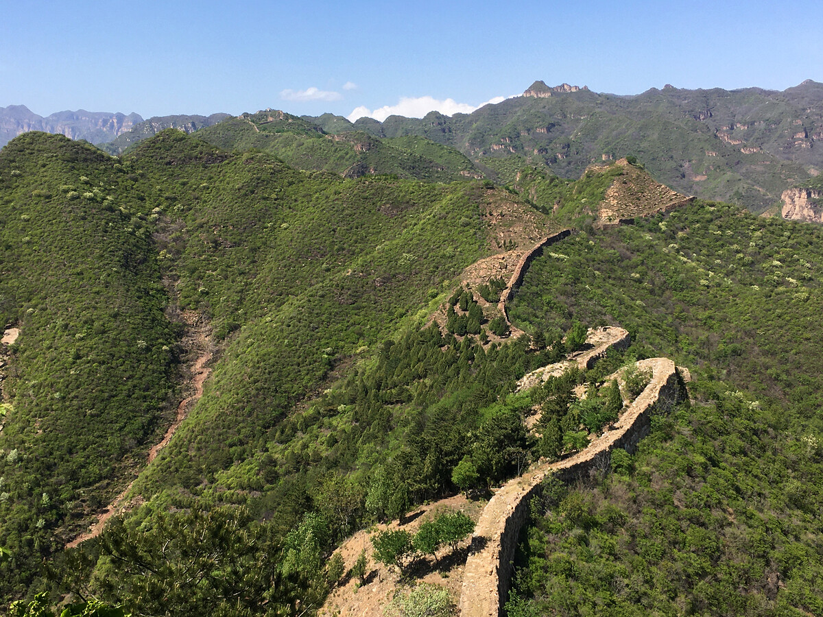
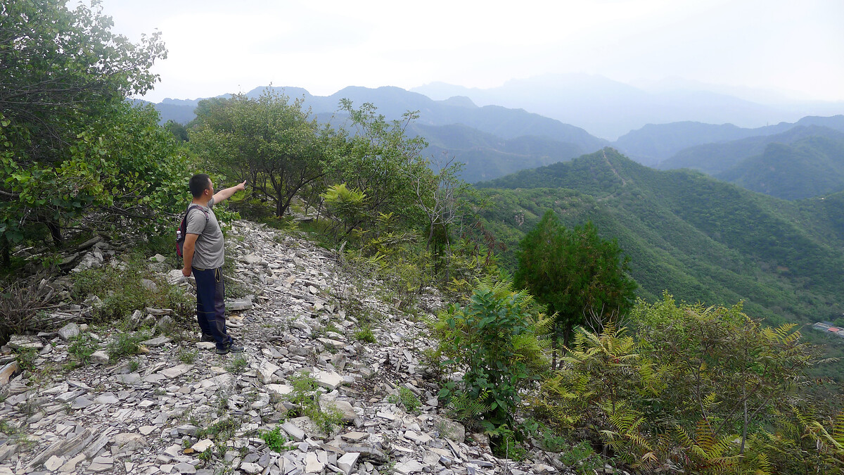
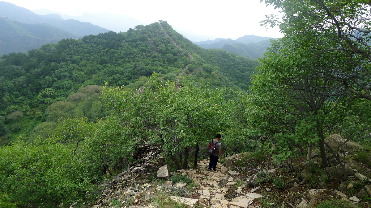
In between the repaired sections the wall here is rough and wild—a low line of locally cut grey and red rocks that runs along a rocky ridgeline, interrupted by cliffs and crags.
Photos (iPhone SE) from a long day in April 2021.
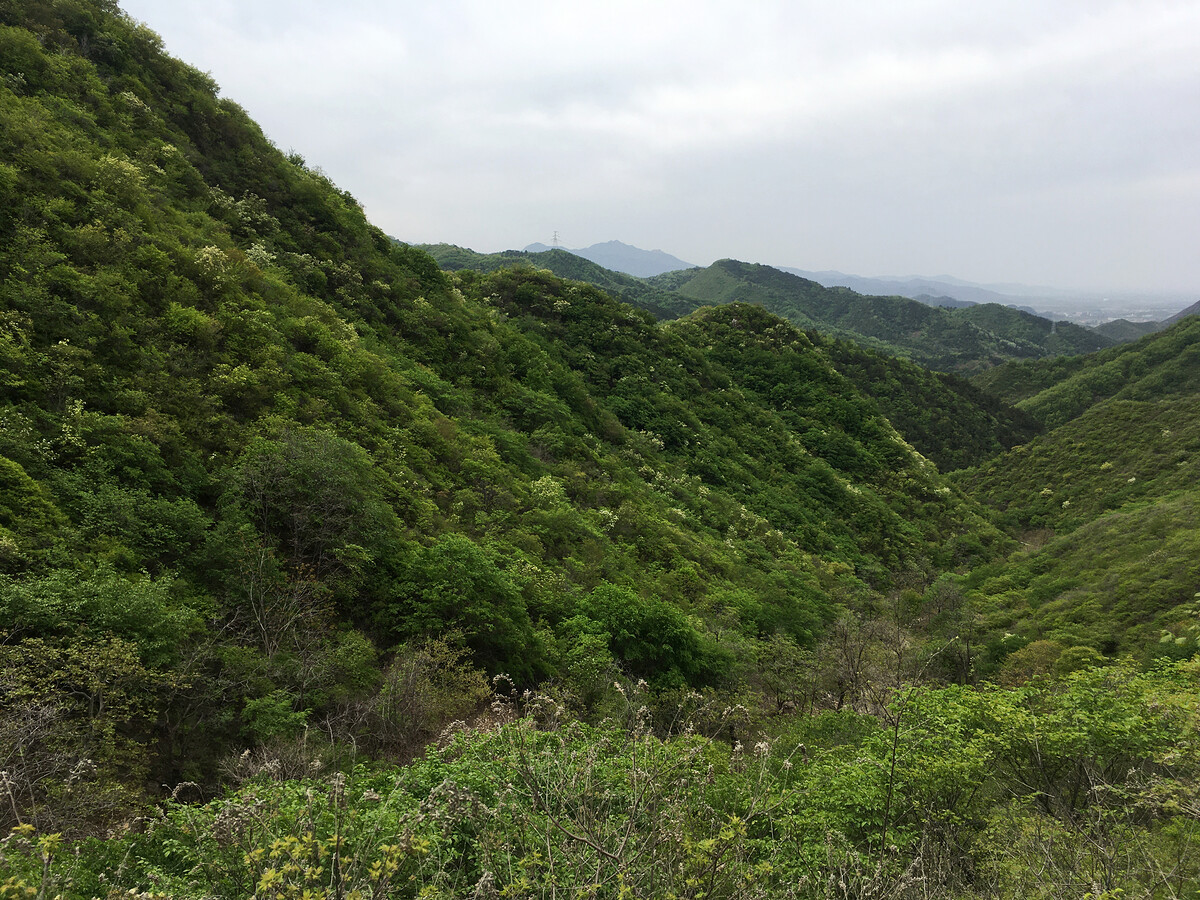


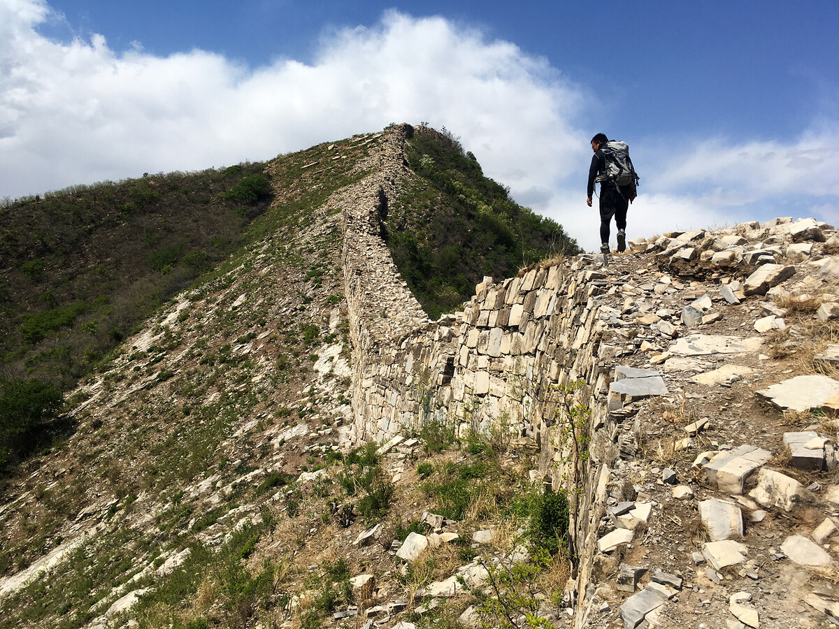
Further along, the stones and rocks of the Great Wall started to show a red tint.
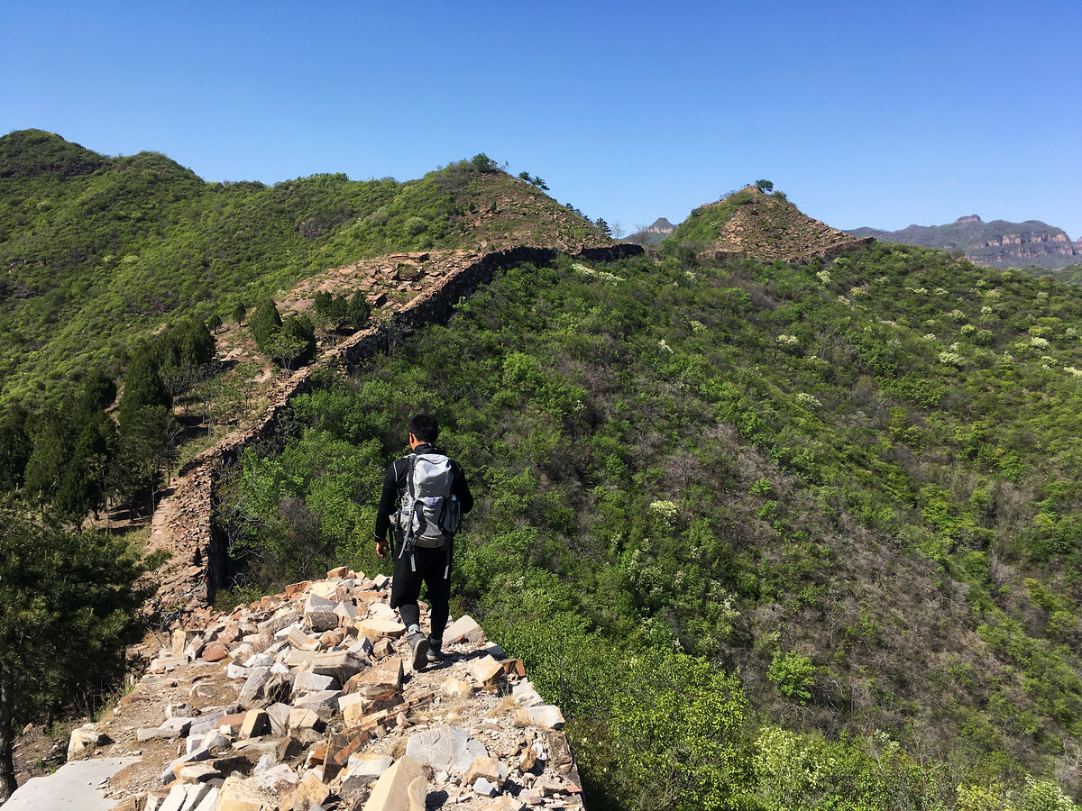

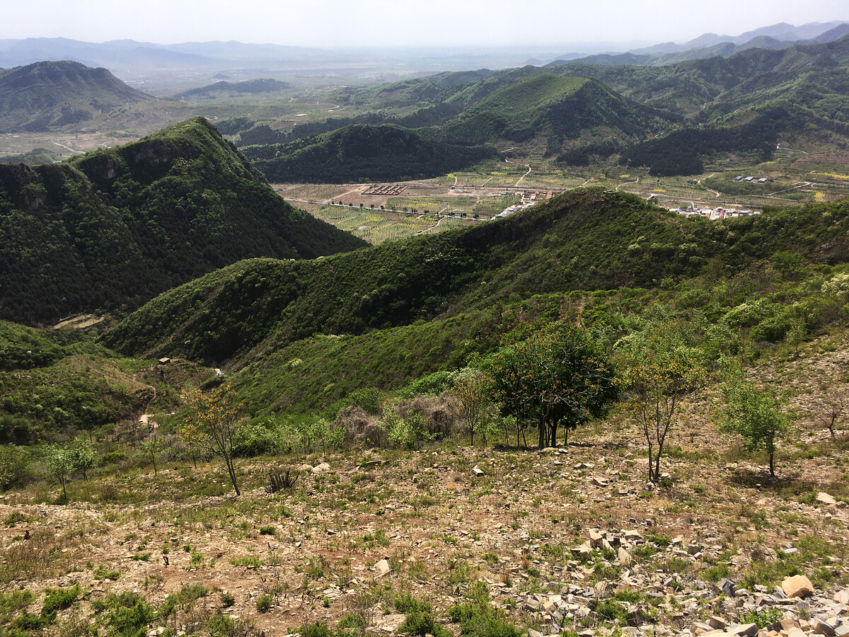
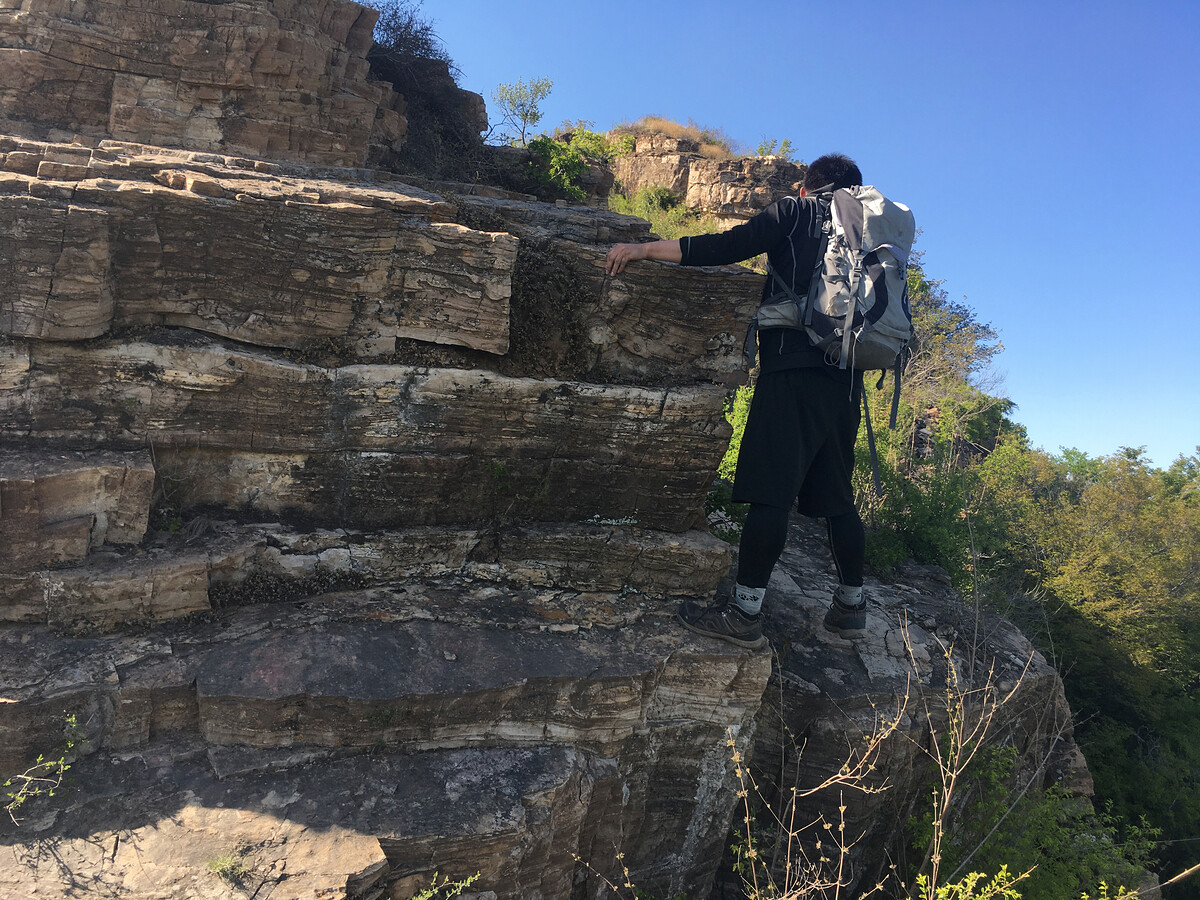
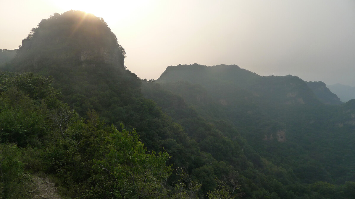
We were expecting to find some cliffs around here. We continued past for a look anyway. Yep, cliffs.
Beijing Hikers has a hike along this part of the Great Wall called “General’s Pass Great Wall”.
From the Sanjiebei to Huangyaguan Great Wall
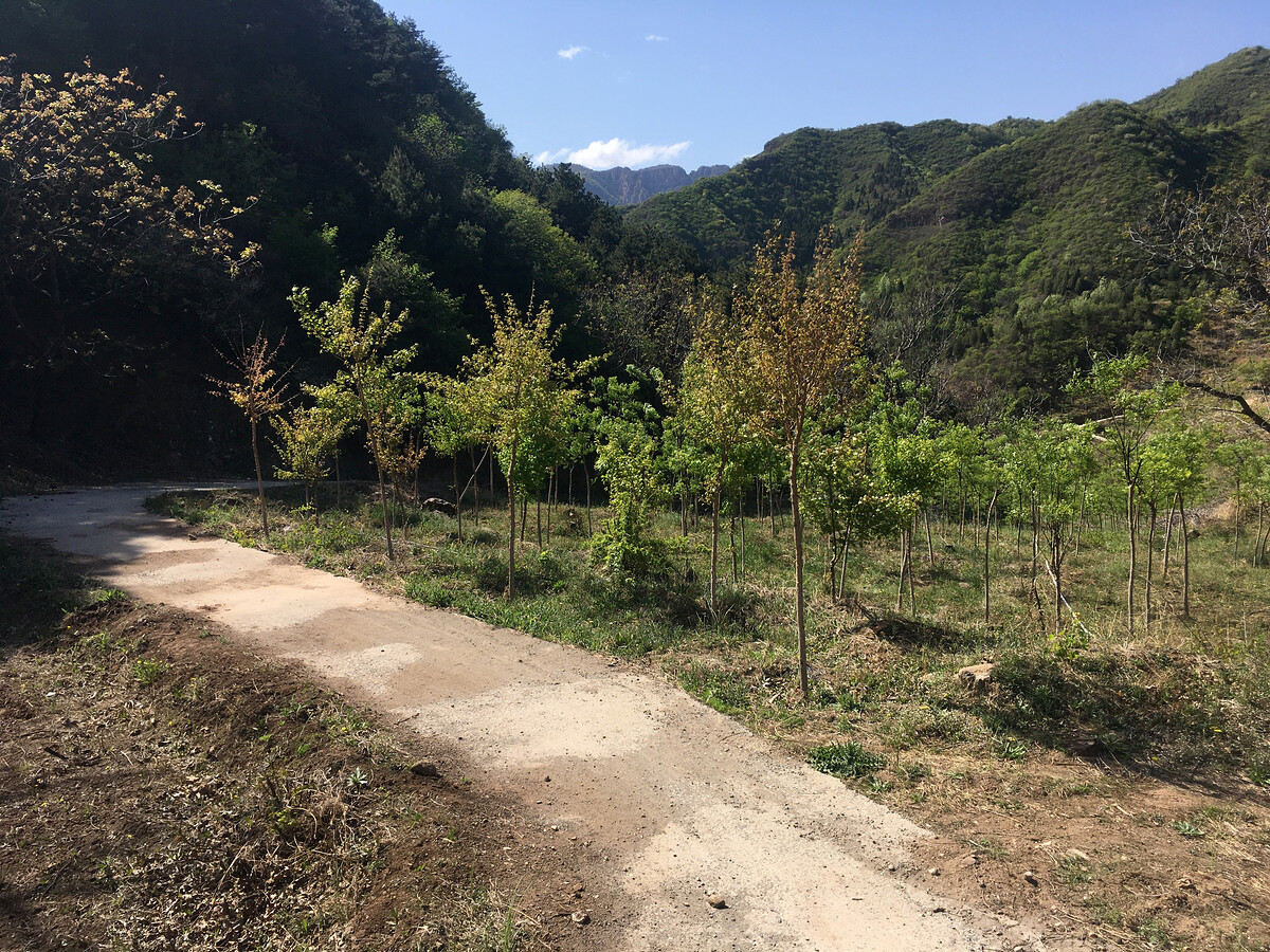
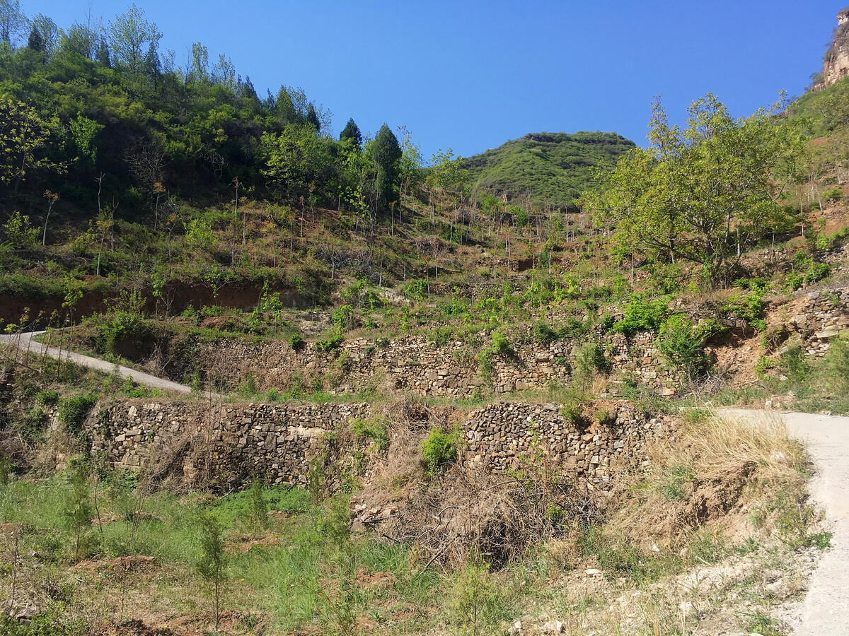
From the tiny (and maybe unofficial) ‘Sanjiebei Scenic Area’ in Hebei over to the wall, down to Qian Ganjian Village, up on to the wall and over to Huangyaguan via the Ganlushan Natural Scenic Area. (12km / 731m ascent / 4.5 hours)
We didn’t get on to the eastern part of the wall at Huangyaguan on this visit. (In the morning we spent too much time early on finding ways to sneak on to the Jiangjunguan Great Wall, and then during an off-piste excursion around a closed tower on Huangyaguan’s west side YS suffered an ankle sprain that swelled to handball size.)
Photos (Leica D-LUX 5) mostly from an extremely long day in September 2021.
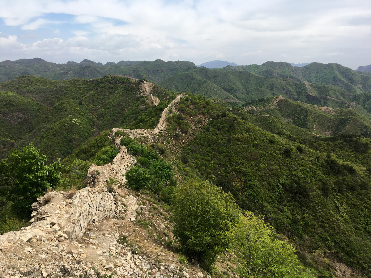
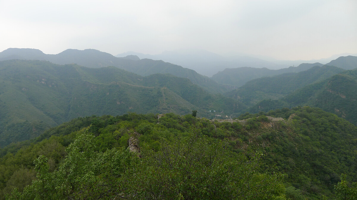
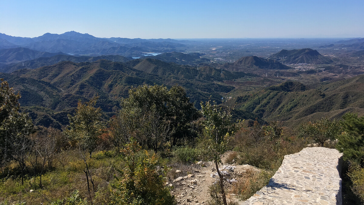
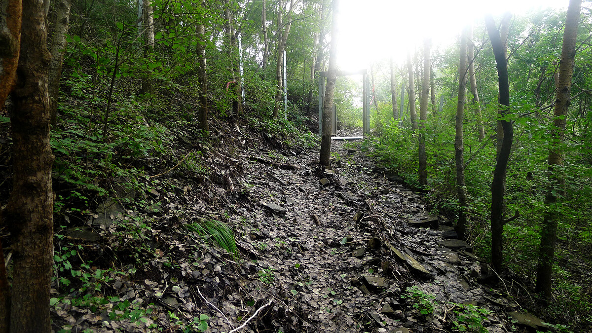
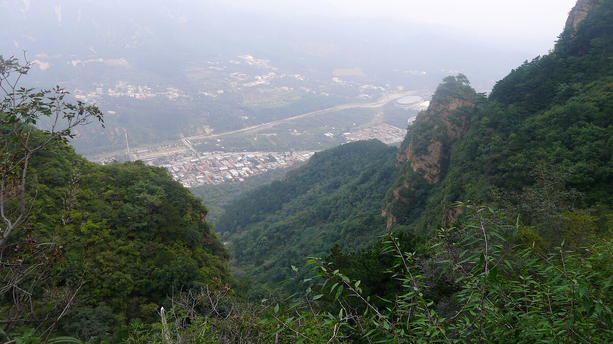
The Great Wall here eventually disappeared into a tangled mess of scrub and forest. We followed side trails around peaks and by cliffs, passing through the Ganlushan Natural Scenic Area on the way to the back door of the Huangyaguan Great Wall.

After detouring around a back door that wasn’t open we arrived at the ‘Heavenly Stairs’, 300+ steps at a ~60° angle.
Almost at the end? Yes … but also no. The next tower down was locked tight. Would we need to go back up the 300+ Heavenly Stairs?
After backing up a few towers we found a gate to clamber over, and set off on the aforementioned off-piste excursion—crashing through bush, sliding down a chest-high cliff, and eventually stepping on the loose rock that spoiled the day.
Notes
Huangyaguan
Huángyáguān / 黄崖关 / Yellow Cliffs Pass
Huangyaguan info on Baidu (Chinese language)
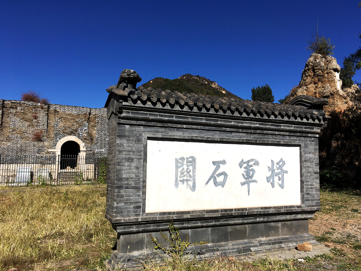
Jiangjunguan
Jiāngjūnguān / 将军关 / General’s Pass
Jiangjunguan info on Baidu (Chinese language)
Hongshimen
Hóngshímén cūn / 红石门村 / Red Stone Gate Village